The Hoarde Vintage - www.thehoarde.com
Sellers's Details
LONDON FINE ANTIQUES
Tel:
Email: [email protected]
https://www.thehoarde.com/dealers/london-fine-antiquesItem Details
Our Stock # 24635
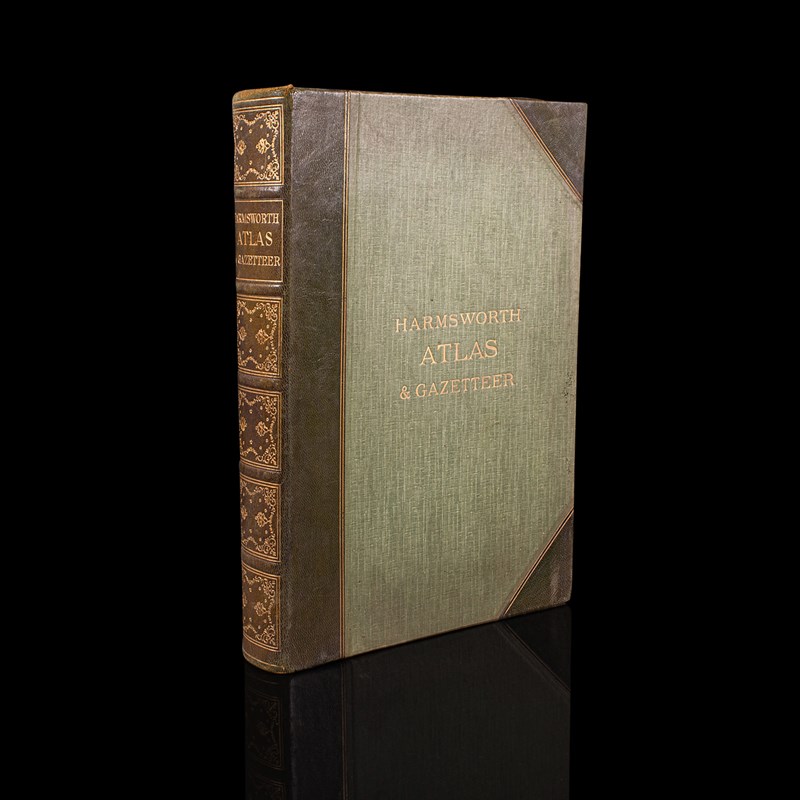
This is an antique Harmsworth Atlas & Gazetteer. An English, bound cartography reference book, dating to the Edwardian period, circa 1910.
- Large and impressive, with exceptional detail and beautifully presented
- In good original order, intact and pleasingly clean throughout
- Bound in green cloth over board, with gilt titling on the leather spine
- Substantial weight in the hand at 5.56kg (12.25 lb)
- Comprehensive, with over 200 double page maps in full colour
- Includes maps of Atlantic Cables, railways and industries to add further detail
- Illustrated sepia-coloured map keys display the upcoming numbered entries
- Fascinating gazetteer to the final pages lists individual places and their map number
This is a superb antique Harmsworth Atlas & Gazetteer, graced with a striking level of detail and offering multiple themes from industry to transport. A treat for a collector or for those with an appetite for geography. Delivered ready to enjoy.
Dimensions:
Max Width: 29cm (11.5'')
Max Depth: 6.5cm (2.5'')
Max Height: 40.5cm (16'')
We offer a 100% satisfaction guarantee with all of our antiques.
We ship worldwide with professional packing and attractive rates – please send us your post / zip code and country for a quote.
Free delivery to most of the U.K. – Please send us your post code for confirmation.
Deliveries taking on average ten working days to arrive at your door from receipt of payment.
Please contact us if you require any further information - we are here to help.
Our Ref: 24635
- Period: c.1910
-
- Price: £465.00
- €554 Euro
- $566 US Dollar
- Location: Devon
-
- Dimensions: H: 40.5cm (15.94in)
- W: 29cm (11.42in)
- D: 6.5cm (2.56in)