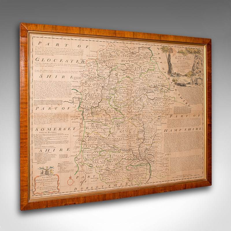
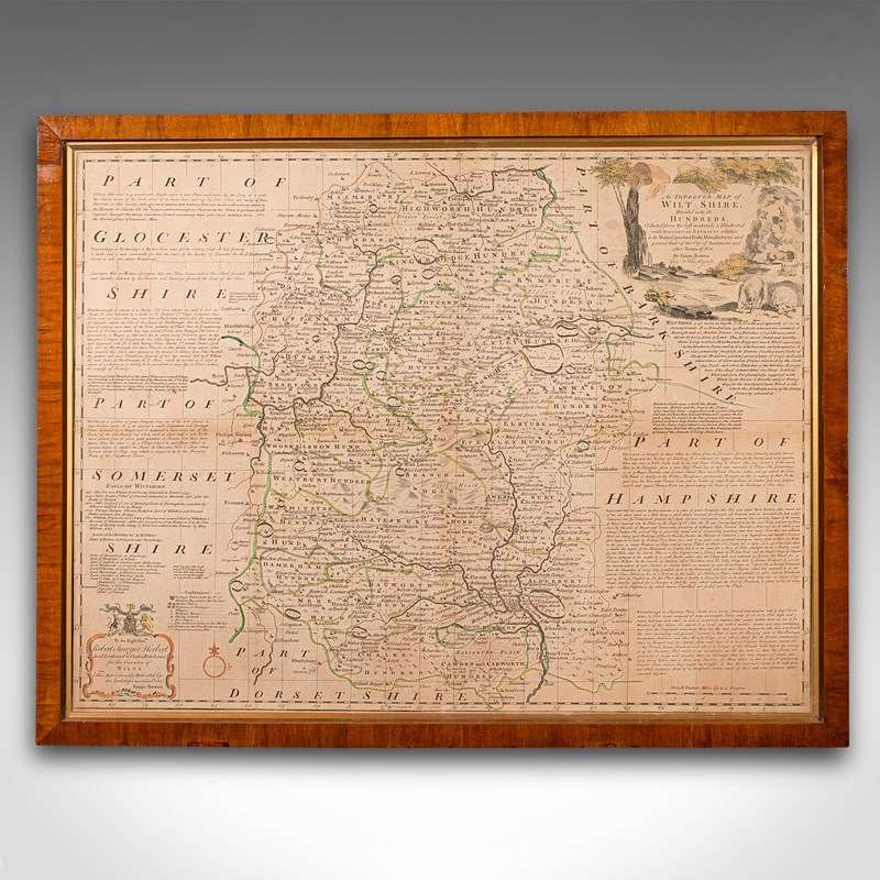


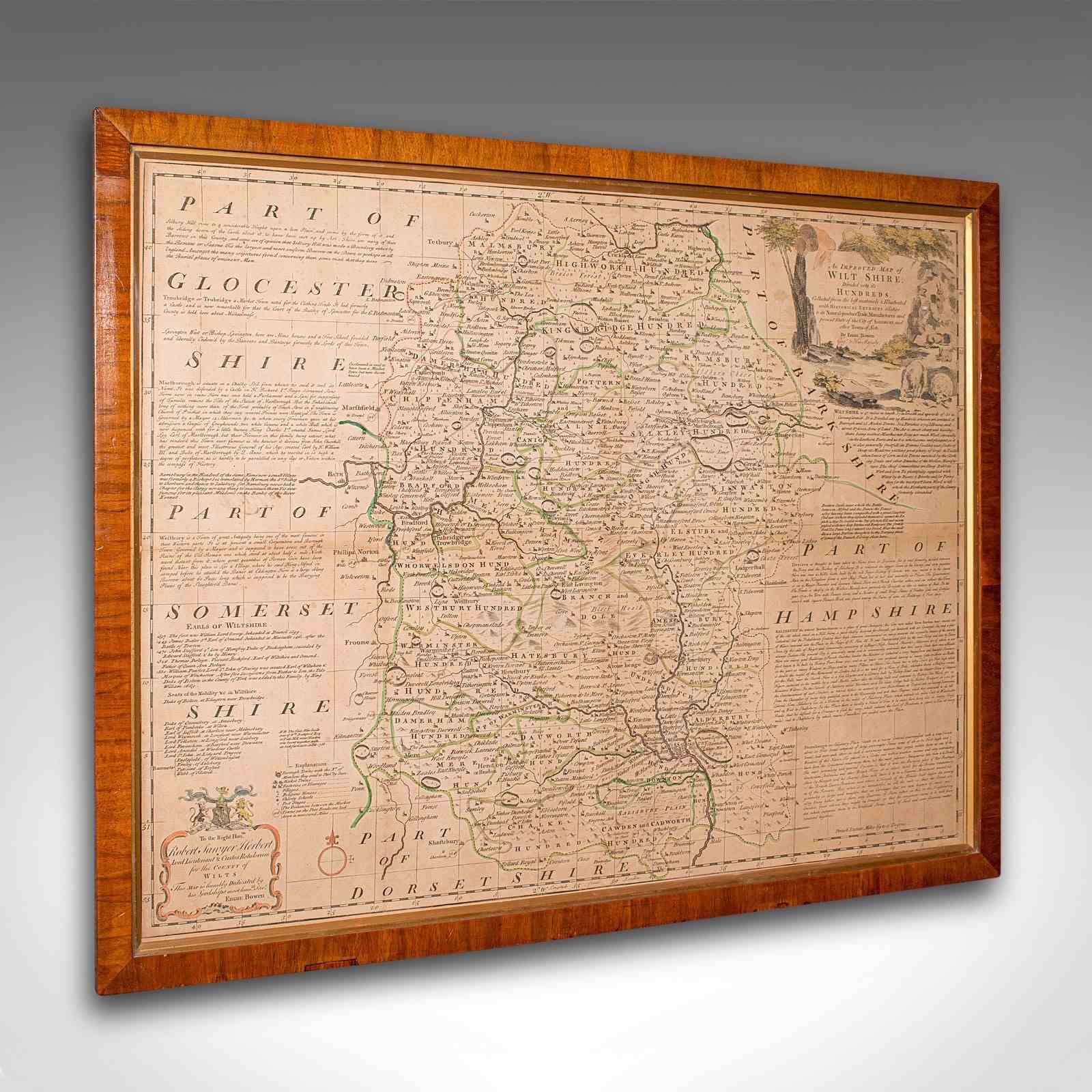
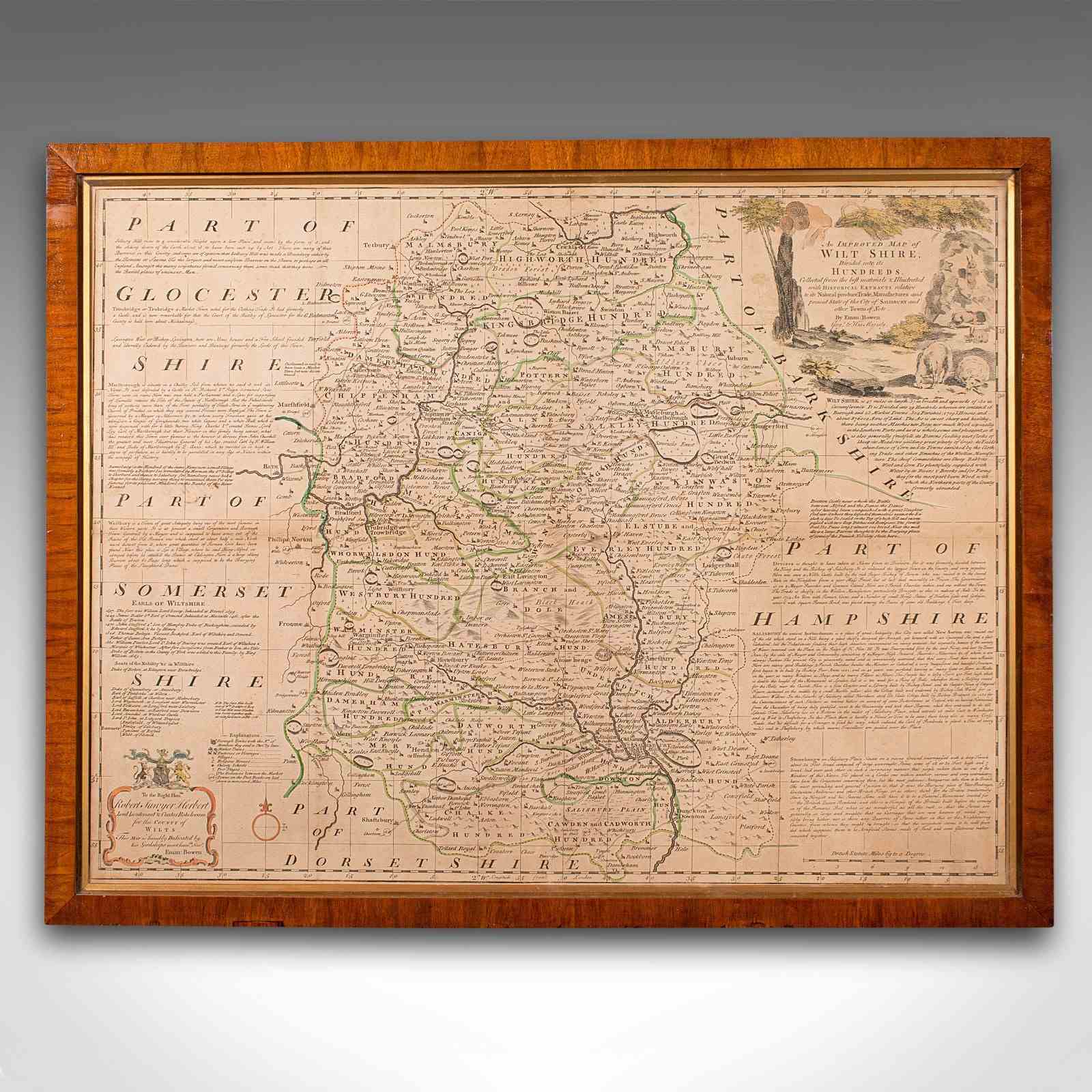
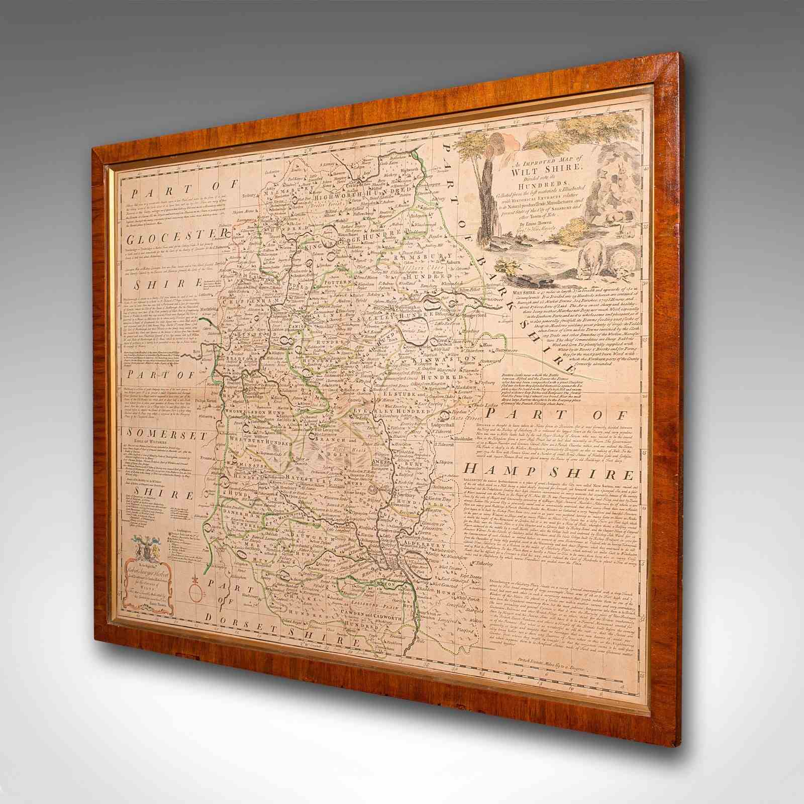
Large Antique Wiltshire Map, County Cartography, Framed, English, 18Th Century
Stock No
25253
2024
- £795.00
- €929 Euro
- $1,019 US Dollar
Questions about this item?
Like this item?
Item Description
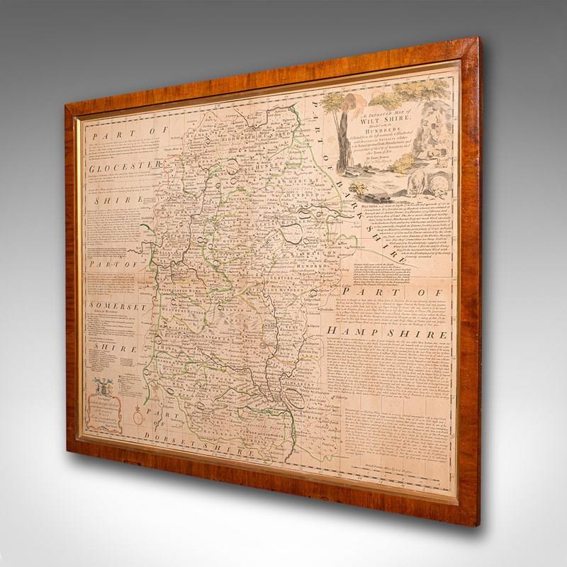
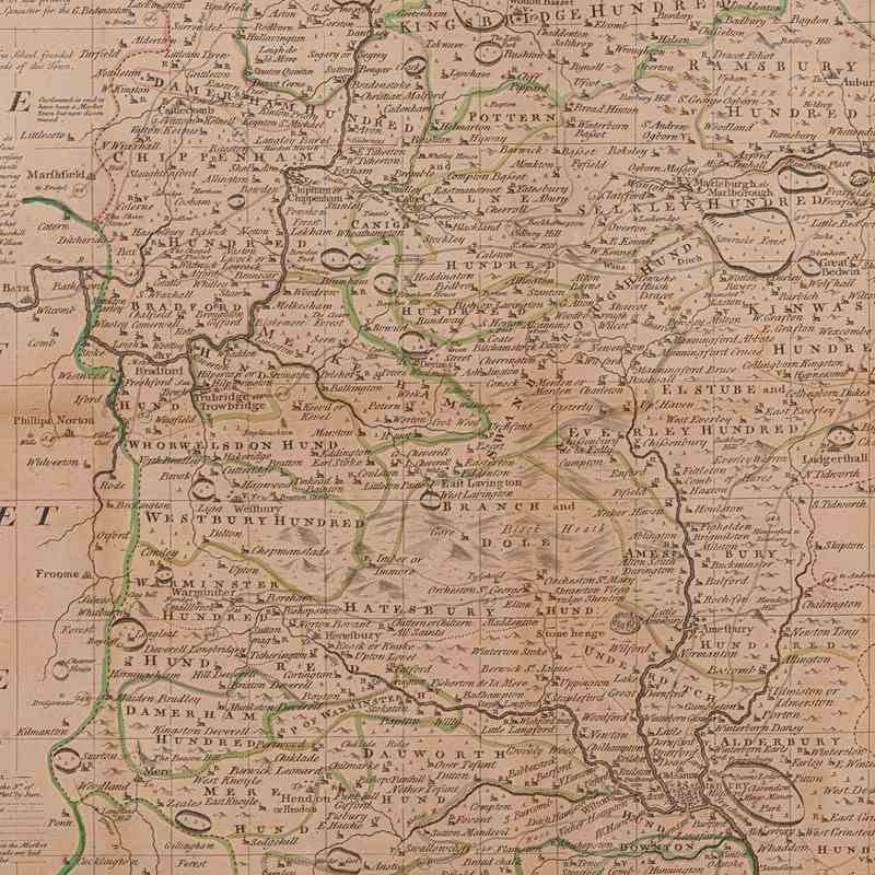
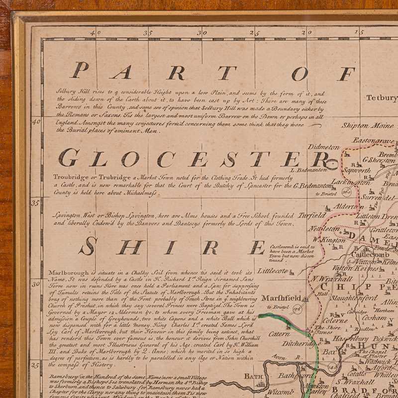
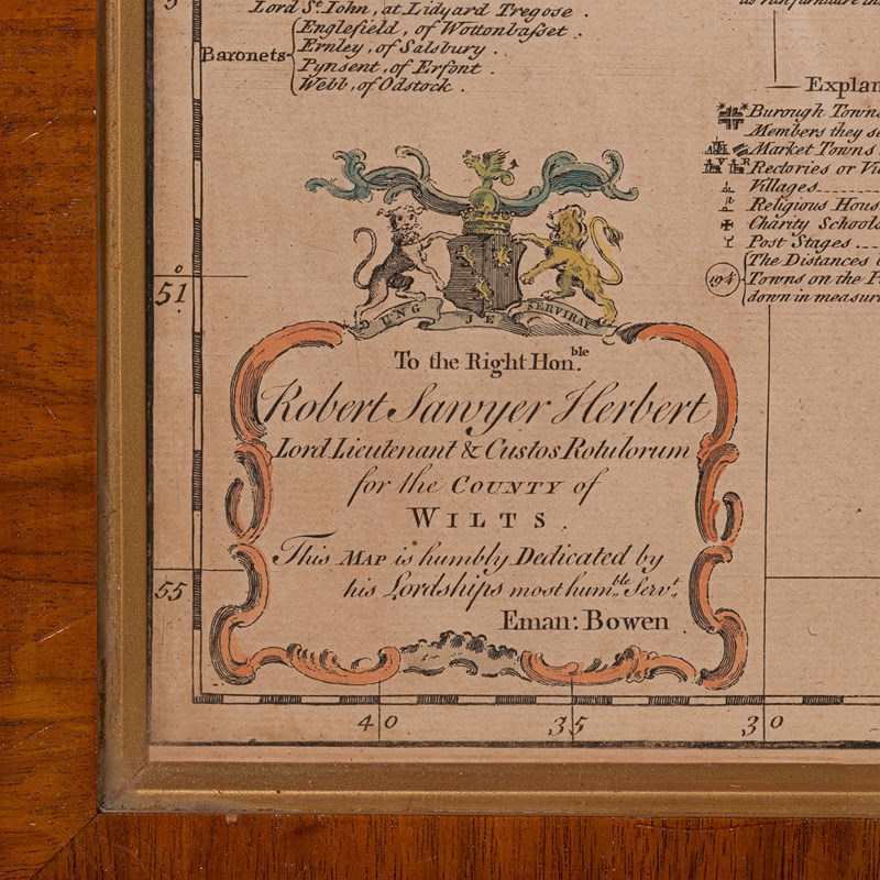
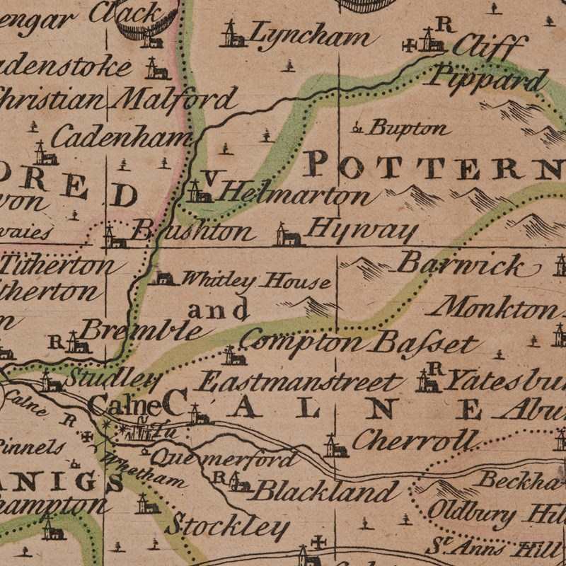
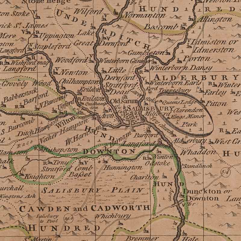
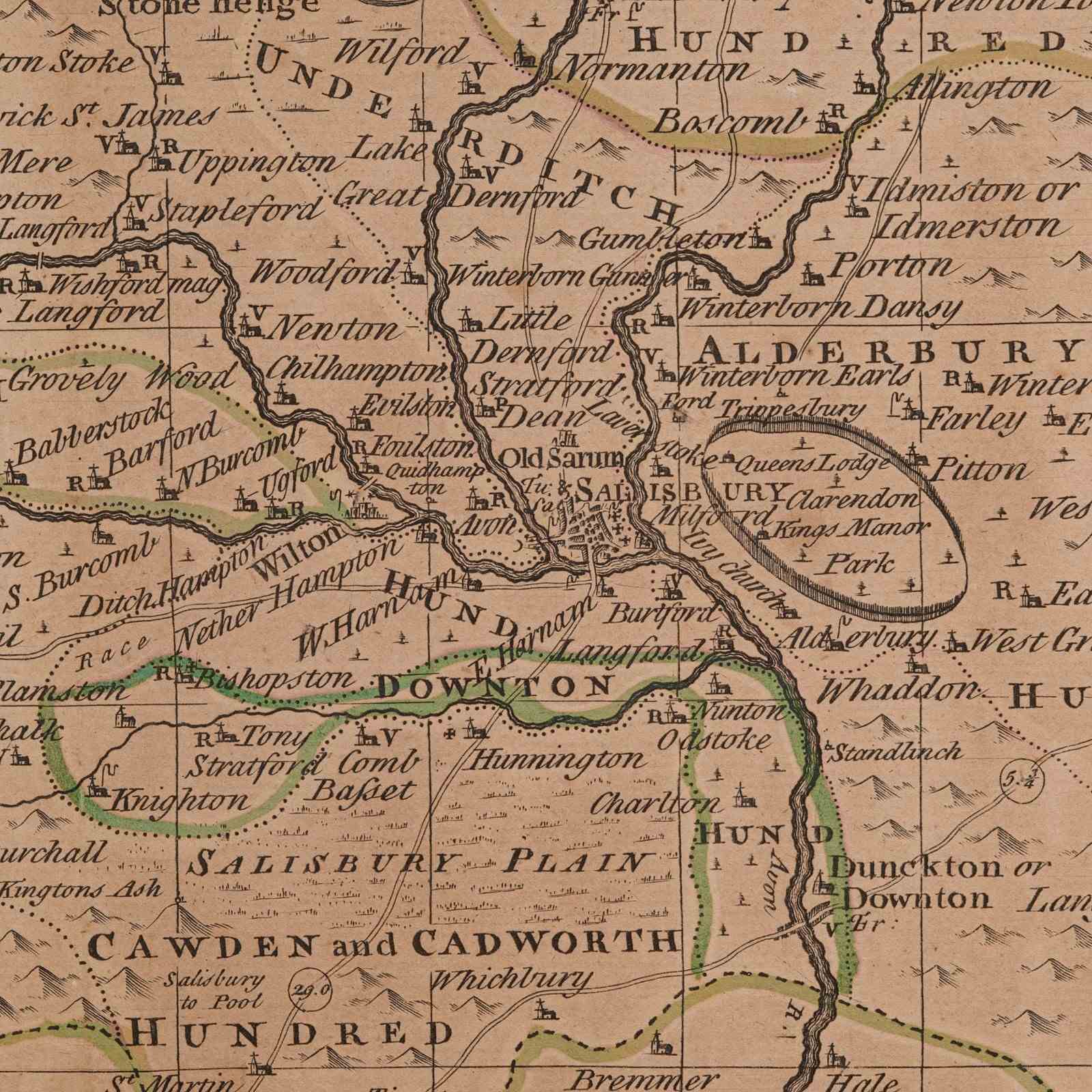
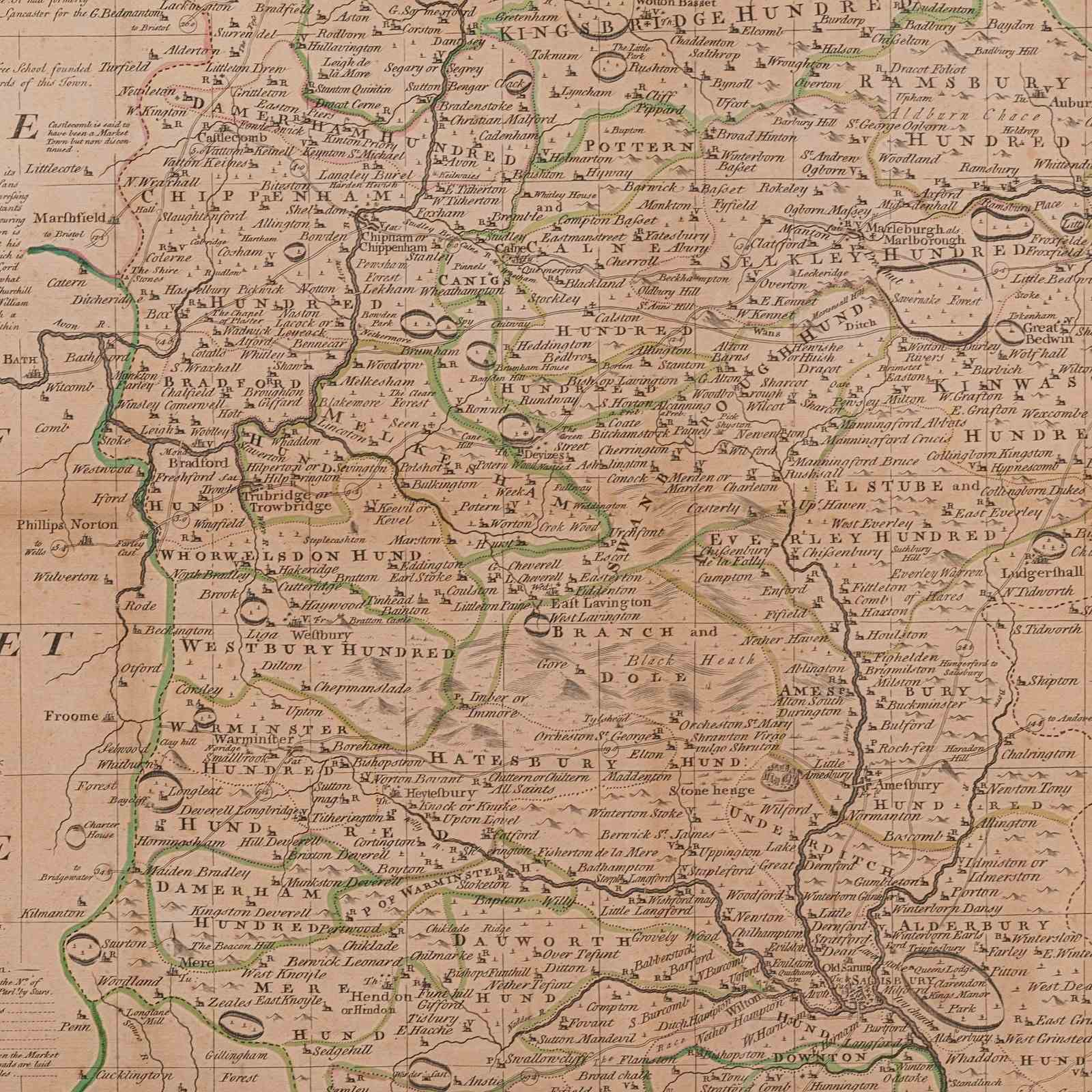
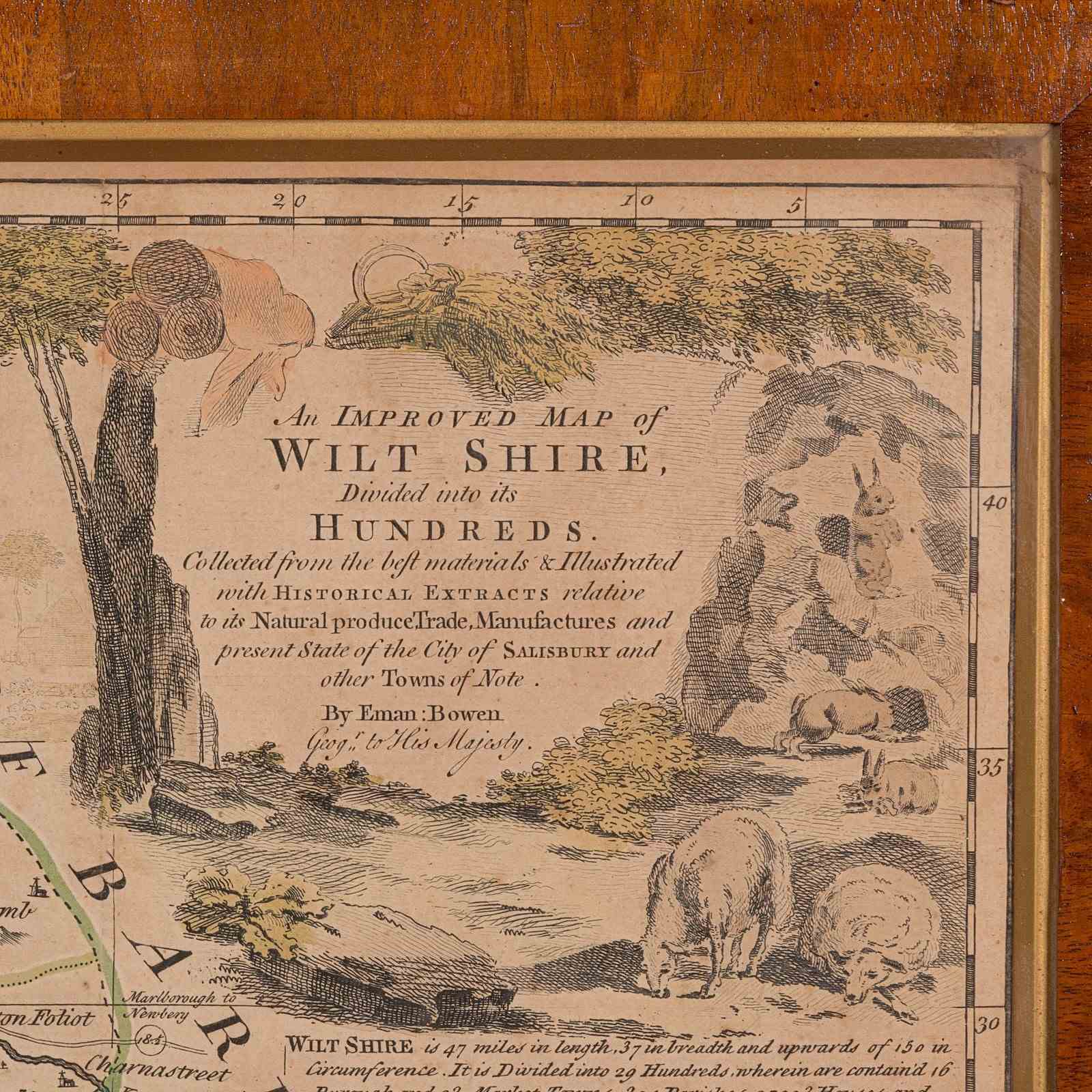
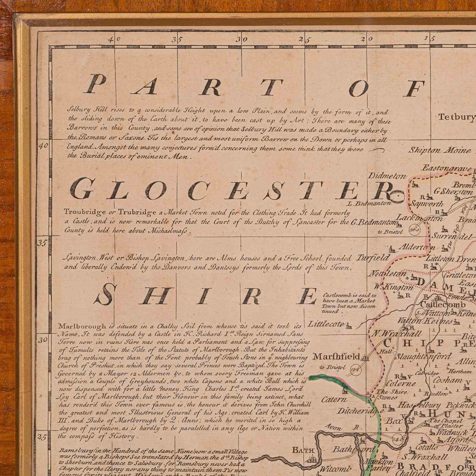
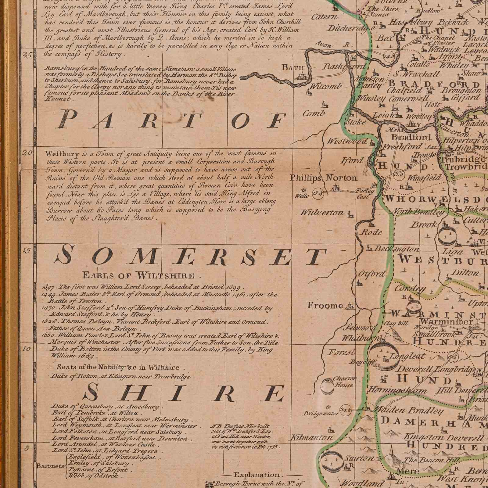
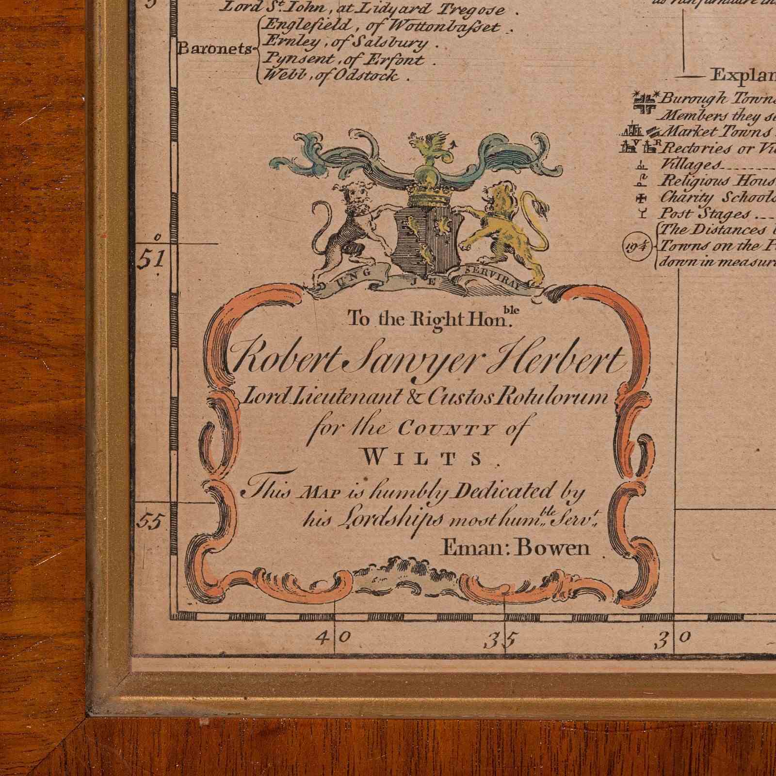
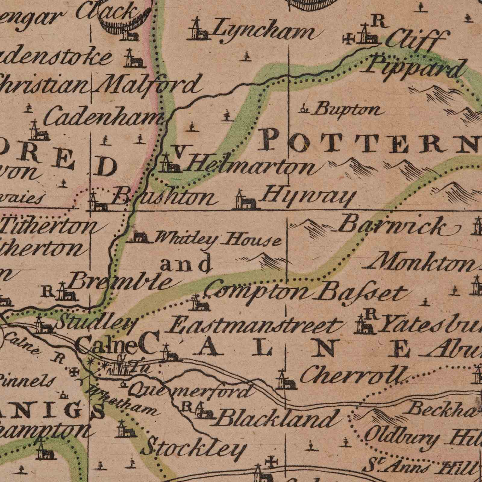
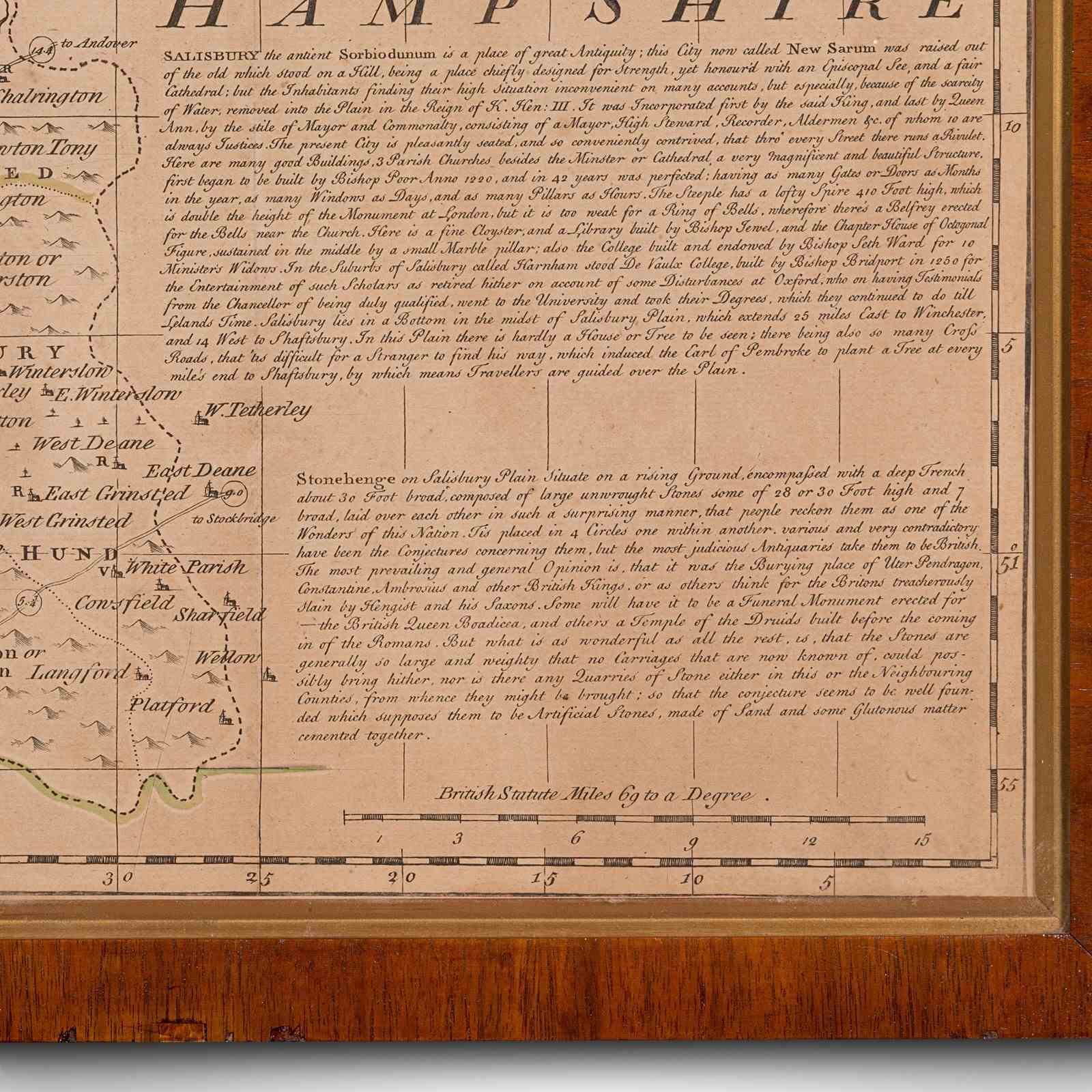
This is an antique county map of Wiltshire. An English, framed atlas engraving of cartographic interest By Emmanuel Bowen, dating to the mid 18th century and later.
Superb lithography of Wiltshire and its county detail, perfect for display
Presents a desirable aged patina and in good order
Fascinating cartography, appealingly set within a quality, later frame
Handcoloured and annotated with excellent town and county detail
Mapped by Emmanuel Bowen (1694 - 1767) in high detail
Dressed to the rear with hanging cord for ease of mounting
This is a quality antique county map of Wiltshire, with fine cartographic interest. Delivered ready to display.
Dimensions:
Max Width: 77cm (30.25'')
Max Depth: 2.5cm (1'')
Max Height: 60cm (23.5'')
Map Width: 70cm (27.5'')
Map Height: 53cm (20.75'')
Item Info
Seller
Seller Location
Hele, Devon
Item Dimensions
H: 60cm W: 77cm D: 2.5cm
Period
1750s
Item Location
United Kingdom
Seller Location
Hele, Devon
Item Location
United Kingdom
Seller Contact No
+44 (0)207 1833511
More from LONDON FINE ANTIQUES