The Hoarde Vintage - www.thehoarde.com
Sellers's Details
MAYFLY VINTAGE
Tel:
Email: helen@mayflyvintage.co.uk
https://www.thehoarde.com/dealers/mayfly-vintageItem Details
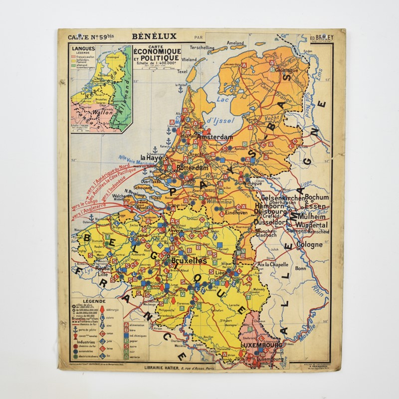
French Vintage Wall Map Hatier 59 – Belgium/HollandFabulous large vintage 1960s double sided geographical school map of the Benelux region, including Belgium, Holland and Luxembourg by French educational map maker Hatier. One side of the map depicts Economic and Political the other side physical Geography.
Origin: School, France
Circa: 1960
Workshop Report: As with all our products, this product is an original vintage item so there are signs of wear from use. There is some watermarking to the outside edges of the map and some tears and holes around the edges of the map.
Additional Info: Price is for a single map
Shipping: Will be Shipped by parcel on a flat wooden board , 3-5 days, Rate is for England only please contact us for other destinations.
- Period:
-
- Price: £165.00
- €192 Euro
- $218 US Dollar
- Location: Wiltshire
-
- Dimensions: H: 99cm (38.98in)
- W: 120cm (47.24in)
- D: 0cm (0.00in)
